What Are The Best Uganda Travel Packages? What Are The Best Uganda Travel Packages? From…
Where to Go for Road Trips in Uganda?
Where to Go for Road Trips in Uganda?
Where to Go for Road Trips in Uganda, A road trip in Uganda is different from a Kenya or Tanzania safari circuit in the most important way: the distances are real but manageable, and what happens between the national parks is as interesting as what happens inside them.
The Albertine Rift Valley drops away to the west as you approach Queen Elizabeth National Park from the Fort Portal side. The Kigezi Highlands in the southwest fold the landscape into something that looks nothing like the East Africa of the tourist brochures.
The drive north toward Kidepo Valley changes gradually from lush equatorial green to the drier, wider, harder landscape of Karamoja, and by the time you cross into that northeastern territory the feeling of the country is completely different from where you started.
This guide covers the best road trip routes in Uganda and what each one reveals about the country beyond the wildlife in the national parks. Whether you are planning a self-drive safari in a hired 4WD or a guided overland circuit with a driver, the routes below give you the most complete picture of what Uganda looks like when you travel through it rather than across it.
Route One: Kampala to the Southwest — The Classic Uganda Road Trip
Kampala → Masaka → Mbarara → Lake Mburo → Mbarara → Kabale → Lake Bunyonyi → Bwindi → Ishasha → Queen Elizabeth → Kasese → Fort Portal → Kampala | 10–14 days | Approximately 1,200 km | The most complete western Uganda circuit
This is the road trip that most visitors to Uganda describe when they say they drove the western circuit. It is a loop that begins and ends in Kampala, covers the country’s southwestern and western parks in a connected sequence without significant backtracking, and passes through enough different landscape types and cultural contexts to feel like a journey through several countries rather than one.
Kampala to the Equator and Lake Mburo — The Opening Stretch
The drive out of Kampala on the Kampala-Masaka highway begins with the slow escape from the city’s traffic and becomes genuinely pleasant once the road clears the outer suburbs and climbs into the rolling countryside south of the capital.
The Equator crosses the highway at Kayabwe, approximately 72 kilometres from central Kampala, marked by a painted circle across the road and a small monument where a guide demonstrates the Coriolis effect using a bowl of water and a leaf. It takes fifteen minutes and provides one of the more reliably enjoyed photographs of any Uganda road trip. From Kayabwe, the highway continues southwest through Masaka town and then turns directly west toward Mbarara.
Lake Mburo National Park sits just north of the main Mbarara highway, accessible through the Sanga Gate about three and a half hours from Kampala. It is the most practical first park stop on the southwestern circuit because it breaks the drive at exactly the right point, offers a walking safari and a lake boat trip that are different from the activities available later in the circuit, and has no lions, which makes the approach feel relaxed. A single overnight at Lake Mburo, departing the following morning for the road south toward Kabale, is a natural fit for the circuit pace.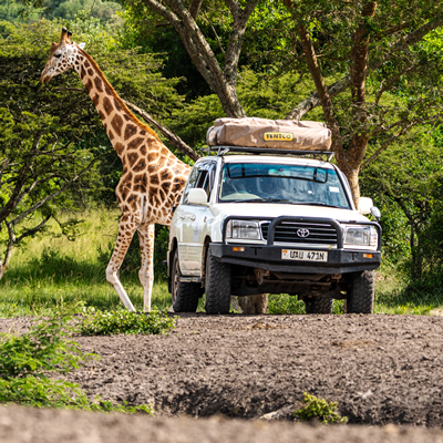
The Drive South from Mbarara — Into the Kigezi Highlands
The road south from Mbarara toward Kabale is one of the most underappreciated drives in Uganda. The landscape begins to change within twenty minutes of Mbarara: the hills become steeper, the terracing on the slopes becomes more elaborate, and the views from the road into the valleys below start to acquire the density and drama that characterize the Kigezi Highlands.
Kigezi is sometimes called the Switzerland of Africa, an overused comparison that nonetheless captures something true about the visual character of the region: terraced hills dropping into narrow valleys with small towns clustered on the ridges above.
Kabale town, the main centre of the Kigezi region, sits at around 1,980 metres above sea level and has a cool, clear quality to its air that is different from the lower-altitude towns to the north. The market in Kabale on the road into town is a genuine local market rather than a tourist-facing one, selling produce, household goods, and crafts at prices set by Ugandans buying for Ugandans. It is worth stopping for thirty minutes simply to watch.
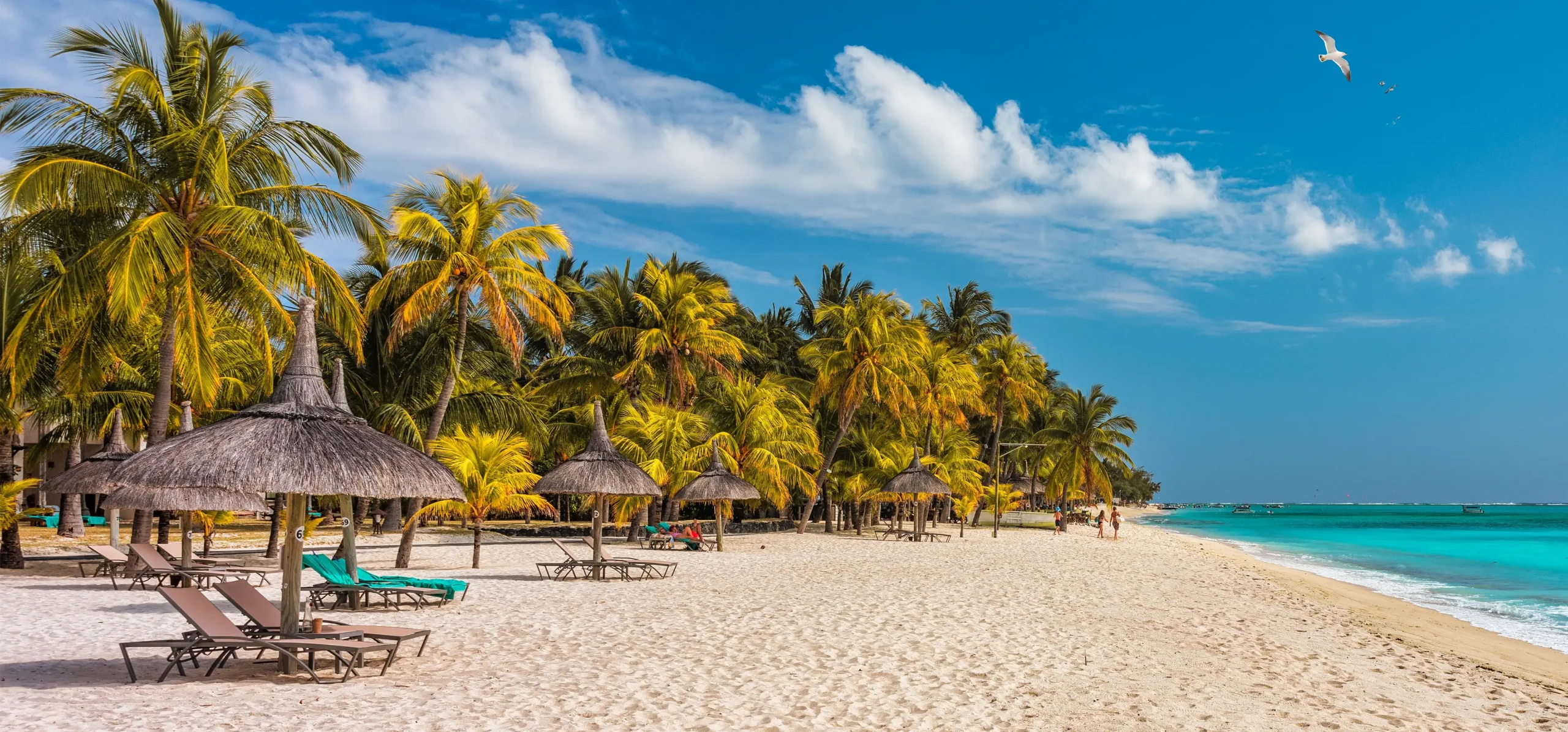
Lake Bunyonyi — The Perfect Overnight Before Bwindi
Lake Bunyonyi is 85 kilometres before the Bwindi briefing point on the main southwestern circuit route, accessible on a short turnoff from the Kabale road. The lake sits in a crater valley at 1,962 metres above sea level, is dotted with islands, and holds a distinctive visual character that differs from every other lake in Uganda.
Unlike Lake Victoria or the Rift Valley lakes, Bunyonyi has no hippos and no crocodiles, and the water is considered safe for swimming, making it genuinely unusual in Uganda. A night at a lakeside guesthouse or lodge on Bunyonyi is the best possible preparation for the early start required the following morning for the Bwindi gorilla trekking briefing.
Bwindi to Ishasha — The Road Through the South
The road from Bwindi’s main sectors to the Ishasha area of Queen Elizabeth National Park runs north from the Kihihi Gate through increasingly open country. This is a section of the circuit that many itineraries rush, treating the Kihihi to Ishasha drive as a transit rather than part of the journey. It should not be rushed.
The road passes through the buffer zone around the park, through community areas where the edge between protected forest and farmed hillside is visible and sometimes striking, and begins to open into the savannah character of the Rift Valley as it descends toward Ishasha.
The Ishasha sector holds Uganda’s tree-climbing lions, which rest in the branches of large sycamore fig trees across the open plains. The Ishasha plains are flat and open in a way that the Bwindi forest is not, and the landscape change between the two within a single afternoon drive gives the physical experience of moving between ecosystem types that a map conveys in the abstract. A night at Ishasha Wilderness Camp inside the sector, with access to morning and afternoon game drives, is the right way to approach the tree-climbing lions rather than a quick afternoon pass-through on the way to Mweya.
Queen Elizabeth to Fort Portal — The Northern Return
The return leg of the southwestern circuit runs north from Queen Elizabeth’s Mweya Peninsula toward Kasese and then east toward Fort Portal before turning back toward Kampala on the main western highway.
The drive from Kasese toward Fort Portal passes through the Rwenzori foothills on the left, with the Mountains of the Moon occasionally visible through the cloud cover above the tea estates, and the road gradually climbs from the Rift Valley floor back into the highland country around Fort Portal. The Fort Portal to Kampala drive of approximately 330 kilometres takes five to six hours and passes through Kibale Forest on the right before the road straightens out for the eastern descent toward Kampala.
Route Two: Kampala to the North — Murchison Falls and the Nile
Kampala → Luwero → Ziwa Rhino Sanctuary → Masindi → Murchison Falls → Gulu → Kampala | 5–7 days | Approximately 700 km return | The northern Nile circuit
The northern road trip follows the main Gulu Highway out of Kampala and is one of the most accessible circuits for visitors with limited time who want Murchison Falls without a two-week itinerary.
The highway north from Kampala through Luwero and Nakasongola covers the triangle district north of the capital, an area with a history of significant conflict during the 1980s civil war that is now productive farmland and low population savannah. The road is good tarmac and the drive to Masindi, the main town before Murchison Falls, takes approximately four hours.
Ziwa Rhino Sanctuary — The Natural First Stop
Ziwa Rhino Sanctuary sits on the main Kampala to Masindi highway, accessible from the road without any significant detour. The sanctuary holds Uganda’s only population of white rhinos, reintroduced from 2005 after the species was poached to extinction in Uganda during the 1970s and 1980s.
The tracking experience is on foot with armed rangers, takes about 90 minutes, and allows an approach to within thirty to fifty metres of individual white rhinos in grassland and acacia woodland. For a family with children aged 6 and above, or for any visitor who has never been within walking distance of a rhinoceros, Ziwa is the most reliably affecting wildlife stop on the northern circuit.
Masindi Town — The Last Good Fuel Before the Park
Masindi is the practical staging point before Murchison Falls National Park and should be used as such. Fill the fuel tank completely. Stock up on water and any food supplies not available inside the park. The Masindi Hotel, one of Uganda’s older properties, has a pleasant verandah and serves food throughout the day.
Ernest Hemingway is said to have stayed there in 1954 following a plane crash while on safari in Uganda, though his account of the experience in Snows of Kilimanjaro predates the exact hotel. The story, verified or not, is still told at the bar.
Murchison Falls National Park — Uganda’s Largest and Most Dramatic
The drive from Masindi into Murchison Falls National Park through the Budongo Forest Reserve is itself one of the better road sections on any Uganda itinerary. The Budongo, one of Uganda’s most significant forests, borders the road for a substantial section of the park approach, and the birding from the vehicle on this stretch is reliably productive.
The Kichumbanyobo Gate, the main southern entry point into the park, is reached after the forest section, and the road from there to Paraa on the Nile crosses increasingly open savannah with wildlife visible from the road in the dry season.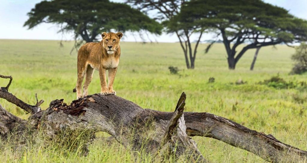
The Paraa ferry crosses the Victoria Nile between the park’s southern and northern sectors, and the ferry crossing itself, watching hippos in the water around the hull while the vehicle is carried across on the barge, is one of the specifically Ugandan experiences of this road trip.
The north bank game drive circuit covers the Buligi tracks through open Borassus palm savannah where Uganda’s largest lion population hunts, and three nights at Murchison Falls gives enough time for the Nile boat cruise, the north bank game drives, and an optional morning in the Budongo Forest for chimpanzee tracking.
The Return via Gulu
The return from Murchison Falls to Kampala can take the same southern route via Masindi and Ziwa, or it can loop northeast through Gulu on the main Gulu highway before turning south back toward Kampala.
The Gulu route is longer but passes through Gulu city, northern Uganda’s main urban centre, which has recovered significantly from the conflict period of the 1990s and 2000s and now has functional hotels, restaurants, and markets. Stopping for lunch in Gulu on the return south gives a sense of northern Uganda’s urban life that the Masindi and Mbarara highway options do not provide.
Route Three: The Western Highlands — Fort Portal, Crater Lakes, and Kibale
Kampala → Fort Portal → Kibale Forest → Crater Lakes → Rwenzori Mountains → Semuliki | 5–7 days | Approximately 650 km return
The western highlands road trip is Uganda’s most scenically concentrated circuit for visitors whose priority is landscape and forest rather than open savannah game drives. The drive from Kampala to Fort Portal, 330 kilometres on the main western highway, is in itself one of the most varied drives in the country: the road climbs from the lake basin through the Mityana escarpment, passes through tea-growing highland country approaching Fort Portal, and delivers its best moment at around 30 kilometres before the town when the Rwenzori Mountains appear on the left horizon.
The Rwenzori View — Uganda’s Most Dramatic Roadside Moment
The Rwenzori Mountains, also called the Mountains of the Moon, rise to 5,109 metres at their highest point and are snow-capped year-round despite sitting directly on the equator. The view of the Rwenzori peaks above the Fort Portal tea estates from the main road is one of those landscape moments that most drivers stop the vehicle for without having planned to. The mountains are often obscured by cloud, particularly in the afternoons, which makes a clear morning view something worth slowing down for. The peaks are visible most reliably in the early morning between January and February and between June and August.
Fort Portal — Uganda’s Most Pleasant Highland Town
Fort Portal sits at around 1,500 metres above sea level in the Tooro Kingdom, historically one of Uganda’s most significant traditional kingdoms. The town has a genuinely pleasant quality: a temperature that rarely feels oppressively hot, a good market, reliable petrol stations, and several well-regarded restaurants and guesthouses.
The Royal Palace of the Tooro Kingdom is on the hill above the town and is open to visitors by arrangement. Fort Portal is the natural base for the western highlands circuit and a good overnight stop both arriving from Kampala and between Kibale Forest and the crater lakes.
The Crater Lakes — Driving Through a Volcanic Landscape
The area around Fort Portal contains over thirty crater lakes formed by volcanic activity, each at a different elevation, some surrounded by forest, others by farmland, and several with lodges positioned on their rims.
Driving through the crater lakes region is one of the more unusual road experiences in Uganda: the road winds between hills and suddenly drops to reveal a perfect circular lake below the road level, sometimes dark and deep, sometimes shallow and vegetated at its edges, always enclosed by the steep circular walls of the former crater. The lakes are visible from the road without stopping at several points, though the ones with the most dramatic views, Kyaninga and Nyinambuga in particular, reward a short stop or a full overnight.
Kibale Forest National Park
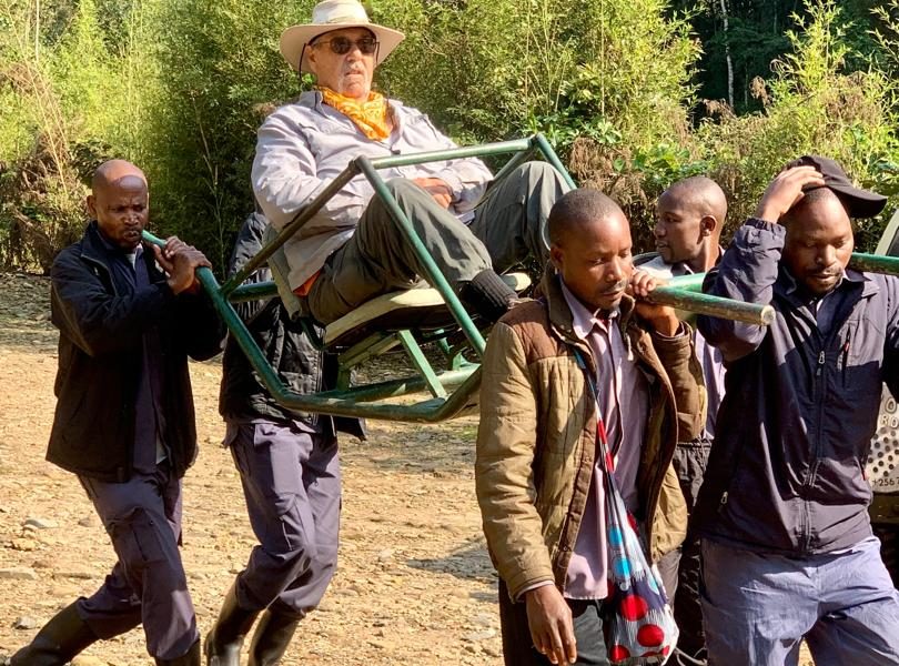
Kibale Forest National Park, 35 kilometres southeast of Fort Portal, covers 795 square kilometres of tropical rainforest and is the best destination in East Africa for chimpanzee trekking. The park is accessible from Fort Portal in under an hour, which makes a morning chimpanzee trek at the Kanyanchu Visitor Centre and a return to Fort Portal for the evening a practical day trip. A stay of two nights inside or adjacent to the park is better: the afternoon at the Bigodi Wetland Sanctuary adjacent to the park, combined with a morning chimpanzee trek, gives a day that covers more of Kibale’s diversity than either activity alone.
The Rwenzori Mountains National Park
The Rwenzori Mountains National Park south of Fort Portal offers multi-day trekking programs to the summit zone and shorter day hikes into the lower afromontane forest for visitors who want the mountain environment without the full summit commitment.
The lower forest hikes, accessible from the Nyakalengija trailhead, pass through dense forest vegetation that becomes increasingly unusual as altitude rises: giant heather covered in moss, giant lobelias with stems two metres high, and the groundsel trees characteristic of East African Afroalpine zones. The day hike into the lower Rwenzori is one of the more botanically distinctive walks available in Uganda and suits any visitor with an interest in highland ecology.
Semuliki National Park — The Congo Basin at Uganda’s Western Edge
Semuliki National Park, accessible from Fort Portal on the road toward the DRC border town of Ntoroko, protects a section of lowland Congo Basin rainforest at the edge of the Albertine Rift. The Sempaya Hot Springs, where boiling water erupts from the earth in two separate vents on the forest floor, are the most visited attraction and accessible on a short walk from the trailhead.
The bird diversity at Semuliki includes Central African species found nowhere else in Uganda, making it the target of dedicated birding road trips in the western circuit. The road from Fort Portal to Semuliki passes through the Rwenzori foothills and descends toward the rift floor in a sequence of altitude and vegetation changes that is worth experiencing slowly.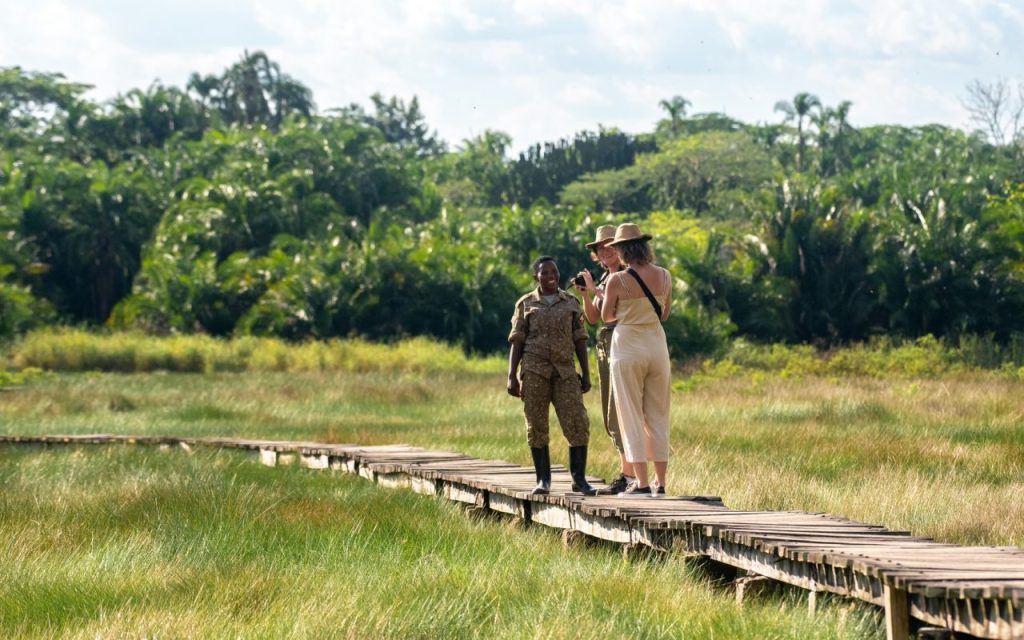
Route Four: The Road to Kidepo — Uganda’s Ultimate Long-Distance Drive
Kampala → Gulu → Kitgum → Kidepo Valley National Park → return via Kotido | 8–10 days | Approximately 1,400 km return
The road to Kidepo Valley National Park is the most demanding and the most rewarding long-distance drive in Uganda. Kidepo is located in the far northeast, in the Karamoja region on the borders with South Sudan and Kenya, and reaching it involves a drive of approximately six to seven hours from Kampala to Gulu, followed by another three to four hours from Gulu to the park boundary through Kitgum.
The total road distance from Kampala to the park gate is around 700 kilometres, and the road quality beyond Gulu is variable in a way that requires a proper 4WD with good ground clearance and a full fuel tank.
The reason to make this drive, rather than take the domestic flight to Kidepo Airstrip, is that the road itself changes meaningfully as it goes north. Leaving Kampala, the country looks like the Uganda most visitors see on any westward drive: cultivated hills, small towns, green farmland. By the time you pass Gulu and continue northeast toward Kitgum, the landscape has begun to change. The population density drops. The vegetation becomes drier.
The hills flatten. By Kitgum the country has the character of northern savanna rather than equatorial highland, and the light has a quality that the lake basin roads do not have: harder, cleaner, more open.
Gulu — The Right Place to Stop Before Karamoja
Gulu is northern Uganda’s main city and the correct stopping point between Kampala and Kidepo for anyone driving the route rather than flying. The city has recovered from the LRA conflict period of the 1980s to 2000s and has a functioning infrastructure of hotels, restaurants, petrol stations, and vehicle services.
Spending a night in Gulu before the final stretch to Kidepo gives time to fill the tank completely, check the vehicle, stock up on water for the Karamoja section, and get an early start for the drive northeast.
The Karamoja Section – Where Uganda Changes
The road from Kitgum toward Kidepo crosses into Karamoja, and the change in the landscape is immediate and dramatic for anyone who has been traveling through the green west and southwest. The soil turns red and the vegetation thins to scattered acacias and dry-country grasses. Flat-topped mountains appear on the horizon in multiple directions.
Karamojong cattle herders move their animals along the road verges, sometimes in herds of hundreds, with the distinctive manyatta homesteads visible on the low rises beside the road. The Morungole Mountains become visible to the northeast as the road approaches the park, and by the time you reach the park gate the country looks nothing like anything you have driven through since Kampala.
The drive through Karamoja is the part of the Kidepo road trip that most visitors with time feel was as significant as the park itself. The remoteness is real, not performed. There are long stretches where there is no other vehicle visible in any direction. The petrol stations are far apart, which is why filling completely in Gulu before departure matters. The road surface varies from acceptable tarmac to rough murram to sections that require careful 4WD navigation, particularly after rain.
Kidepo Valley National Park — The End of the Road Worth Reaching
Kidepo Valley National Park is consistently described by visitors who reach it as the most remote and the most visually striking park in Uganda. The Narus Valley, the park’s primary game viewing area, is a sweeping open plain ringed by mountains and rocky escarpments.
The wildlife density is significant: approximately 130 lions, the only cheetah population in Uganda, elephants, buffaloes, zebras, giraffes, ostriches, and a range of antelope species uncommon in the western parks.
The game drives happen against a background of mountains in every direction, and the vehicle density on any given morning is typically one or two vehicles total. Apoka Safari Lodge inside the park has the best position for valley views and the most experienced guiding team for Kidepo-specific wildlife.
Route Five: The Eastern Escape — Jinja, Sipi Falls, and Mount Elgon
Kampala → Jinja → Mbale → Sipi Falls → Mount Elgon National Park → return via Tororo | 4–5 days | Approximately 500 km
The eastern Uganda road trip is the most overlooked circuit in the country, partly because the parks and destinations on the eastern route are less famous than the western and northern parks, and partly because Jinja tends to be treated as a day trip from Kampala rather than the starting point of a longer eastern journey.
The 80 kilometer drive from Kampala to Jinja is the straightest road in Uganda and takes about two hours in moderate traffic.
Jinja — Uganda’s Adventure Capital at the Source of the Nile
Jinja sits on the northern shore of Lake Victoria at the point where the Nile leaves the lake and begins its 6,400-kilometre journey north to the Mediterranean. This geographical fact gives the town a significance that its size does not immediately suggest, and the source of the Nile boat trip from Jinja’s waterfront, covering the papyrus islands and the exact point where the lake water begins to flow as a river, is one of the more thought-provoking wildlife-free activities available on any Uganda trip.
White-water rafting on the Nile between Jinja and the rapids downstream is one of the finest commercial rafting runs in the world, and the full-day raft at Grade 4 and 5 rapids is the main reason most visitors come to Jinja specifically.
The Drive from Jinja to Mbale — Eastern Uganda’s Interior
The drive from Jinja to Mbale covers approximately 120 kilometres on a road that climbs from the Lake Victoria basin into the more elevated agricultural country of eastern Uganda. Mbale is eastern Uganda’s main commercial city, a market town at the foot of Mount Elgon with a productive agricultural hinterland and a lively town centre.
The coffee farms and banana plantations on the approach to Mbale are among the more densely cultivated landscapes in the country, and the visual character of the eastern agricultural interior is completely different from the savannah country of the northern circuit or the rainforest belt of the western parks.
Sipi Falls — Eastern Uganda’s Most Striking Natural Feature
Sipi Falls, on the western slopes of Mount Elgon near the town of Kapchorwa, is a three-tiered waterfall system dropping into the valley below in sequence. The drive from Mbale to Sipi, approximately 47 kilometres on a road that winds up the mountain through coffee farming villages, is itself excellent: the road climbs through small communities where Arabica coffee is grown on smallholder plots, the view behind the vehicle opening progressively across the eastern Uganda plains as altitude increases.
The falls themselves are best reached on a two to three-hour guided walk from the village near the top, which covers all three tiers and involves some scrambling near the lower two.
The coffee experience at Sipi is worth specifically building time for. Several local operators offer a farm-to-cup tour of the coffee production process, visiting the picking, washing, drying, and roasting stages on smallholder farms and finishing with a cup of the same Arabica that goes into some of the finest single-origin coffees sold in Europe and North America. The coffee at Sipi is excellent, the process is genuinely educational, and the community income from the tours is directly traceable.
Mount Elgon National Park
Mount Elgon National Park straddles the Uganda-Kenya border and is geologically distinctive: the volcano is extinct, the caldera at the summit is 40 kilometers across, making it the widest caldera of any extinct volcano in Africa, and the lower slopes are covered in montane forest that gives way at higher altitude to the distinctive Afro-alpine moorland of the upper zones. Multi-day summit treks take three to four days and involve camping in the caldera.
Day hikes from the Budadiri trailhead on the Ugandan side are accessible without summit commitment and give the lower forest environment, its primates, its birds, and its specific botanical character, in a single long morning.
Best Time for a Uganda Road Trip
The dry seasons, June through September and December through February, give the most reliable road conditions on Uganda’s more remote routes. The Bwindi approach roads are drier, the Kidepo section of the northern circuit is more consistently passable, and the park interior tracks are firmer.
For the main tarmac highway circuits covering Lake Mburo, Queen Elizabeth, and Murchison Falls, the roads are accessible year-round and the dry season advantage is mainly in trail and track conditions rather than in the road quality itself.
The wet seasons, March through May and October through November, bring rain that makes the Bwindi approach and some sections of the Karamoja road significantly more challenging. They also produce the most photogenic Uganda: the hills in the southwest are intensely green, the waterfalls across the country run at full volume, and the light after afternoon showers has a clarity that the dry season dust cannot match.
For road trippers in a properly equipped 4WD who are comfortable with challenging conditions, the wet season is not a reason to cancel. For anyone planning to drive a less capable vehicle on remote routes, the dry season is the right choice.
Related Posts